This week’s challenge:
Play with Google Maps. This is a helpful tool for determining the locations of addresses in your family history. Where your ancestral homestead once stood may now be a warehouse, a parking lot or a field. Perhaps the house is still there. When you input addresses in Google Maps, don’t forget to use the Satellite View and Street View options for perspectives that put you were right there where your ancestors once stood. If you’ve used this tool before, take sometime and play with it again. Push all the buttons, click all the links and devise new ways it can help with your personal genealogy research. If you have a genealogy blog, write about your experiences with Google Maps, or suggest similar easy (and free) tools that have helped in your own research.
I use Google Maps all the time. I have several maps that I’ve plotted my family’s residences and cemeteries. I had mainly focused on my Chicago families, which is a difficult task since I have to convert addresses prior to 1909 in order to find the correct placement on today’s map. Additionally, many street names have changed over the years, adding an extra step in some cases.
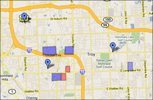
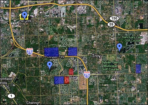
Since I’ve been working on my Oakland County, Michigan folks, I thought I’d do some plotting on Google Maps. Right now, the map includes all the cemeteries were my family is buried, as well as outlines of the land my family purchased through the federal government in the 1820s. This was the first time I’ve plotted anything from a township map on a street map. Fortunately, I was able to find a township map online from 1990 that also included the street names, so I was able to figure it out!!

The nice thing about Google Maps is the Satellite view. In one case, I was not able to find a cemetery because it was not labeled on the map. All I had was a general description of where it was located. I switched to Satellite view and was able to see the cemetery in order to plot the exact location.

You’re welcome to take a look at this particular map of my Family in Oakland County, Michigan, to see how I use this application. Another map that I created to help me with my Emil MILLER research can be viewed here. In this case, I am trying to find applicable Emil MILLER/MULLER/MUELLERs that could be my Emil. I’ve plotted those found in the Chicago city directories in Google Maps, for those who resided close to the church were three generations passed through. There are quite a few, but it’s helped me to narrow down the possibilities based on location to the church.

I really like this use of the Google Maps. The Webster land in section 6 and section 5 is just a mile from my home!
Cool! You’ll have to show me around whenever I get out there. Still planning for sometime this year. Probably spring or summer.